
Reading the crater landscape
Use the rim, water and changes in vegetation to understand the crater within the wider Ngorongoro Conservation Area.
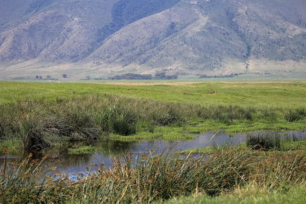
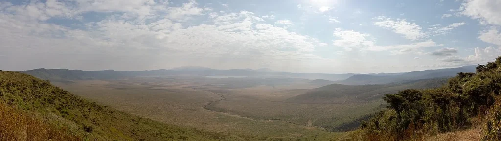
From a rim viewpoint, Ngorongoro can seem like one complete scene. Looking more carefully reveals several settings within it: open ground, wooded patches, water and the surrounding slopes. Begin with those relationships, then let individual observations add detail. This approach gives a crater visit interest even when an expected animal remains out of sight.
Place the basin in its wider setting
Ngorongoro Crater is a volcanic caldera formed by collapse, one of several major landforms in the highlands. The Ngorongoro Lengai Geopark’s caldera interpretation connects it with the separate Olmoti and Empakaai craters. They deserve their own planning decisions; a booking described simply as Ngorongoro may include only the main crater.

Balloon Safari & Bush Breakfast in Serengeti - Miracle Experience
Miracle Experience is a premier eco-luxury Hot Air Balloon Safari company based in Tanzania. Our incredible safaris over the Serengeti and Tarangire N...

Serengeti Balloon Safari and authentic bush breakfast
Some things are worth getting up early for and this is certainly one of them. The wonderful experience of a hot-air...

Materuni Waterfalls, coffee tour & Kikuletwa Hot Springs
A comprehensive trip, combining hiking, coffee learn, local brewers & a refreshing dip at the hot springs Great cha...

4h Quad Adventures in Zanzibar: Nungwi / Kendwa Transfer inclus
The price for this activity applies to a maximum of 2 people per Quad. Whether you book for one or two people, the p...
Ask your guide to identify the rim, the route into the basin and the direction of the next part of your journey. A quick orientation makes later stops easier to remember. Keep any map or downloaded itinerary available without relying on a phone connection at each viewpoint.
Follow the water
The geopark describes the Munge River as beginning in Olmoti before entering Ngorongoro Crater and eventually reaching Lake Magadi. That connection offers a useful way to look beyond the apparent boundary of the rim. The basin receives influences from the landscape around it.
At a permitted stop, compare the vegetation beside water with the more open ground farther away. Ask what your guide can identify and what changes with conditions. Photographs taken on different dates can show quite different appearances, so avoid using a single image as a forecast for your visit.
Make space for observation
- Begin with the broad landform before concentrating on an individual animal.
- Use binoculars or a longer camera view while maintaining the distance directed by your guide.
- Keep a short note of the place and habitat as well as the species you think you saw.
- Follow instructions about permitted stops and remaining in the vehicle.
These small habits turn a collection of photographs into a more coherent record. They also reduce the temptation to judge the day entirely by a list of sightings. A guide can explain uncertainty; an honest identification sometimes remains provisional.
Leave room for another chapter

Affordable and Reliable Taxi Services in Zanzibar Island
Our services are reliable and affordable, our drivers are very friendly and they are willing to provide extra help to our customers to reach where the...

Mnemba Island snorkeling and Swimming with Dolphin
Increase your chances of spotting some of Tanzania’s rarest marine life during a snorkeling tour that takes you to...

Private/Sharing: Explore Mnemba Island with a dhow
Enjoy a full day trip to Mnemba Island with one of our traditional Dhows. Mnemba Island is a small island located ou...

Balloon Safari & Bush Breakfast in Tarangire - Miracle Experience
Miracle Experience is a premier eco-luxury Hot Air Balloon Safari company based in Tanzania. Our incredible safaris...
UNESCO’s conservation-area description includes highland, woodland, grassland and archaeological values beyond the crater. Choose one of those interests for a separate part of your itinerary. Our highland walking guide and Olduvai introduction explain questions worth asking before you add either to a trip.
.jpg)
